
Measured building Surveys
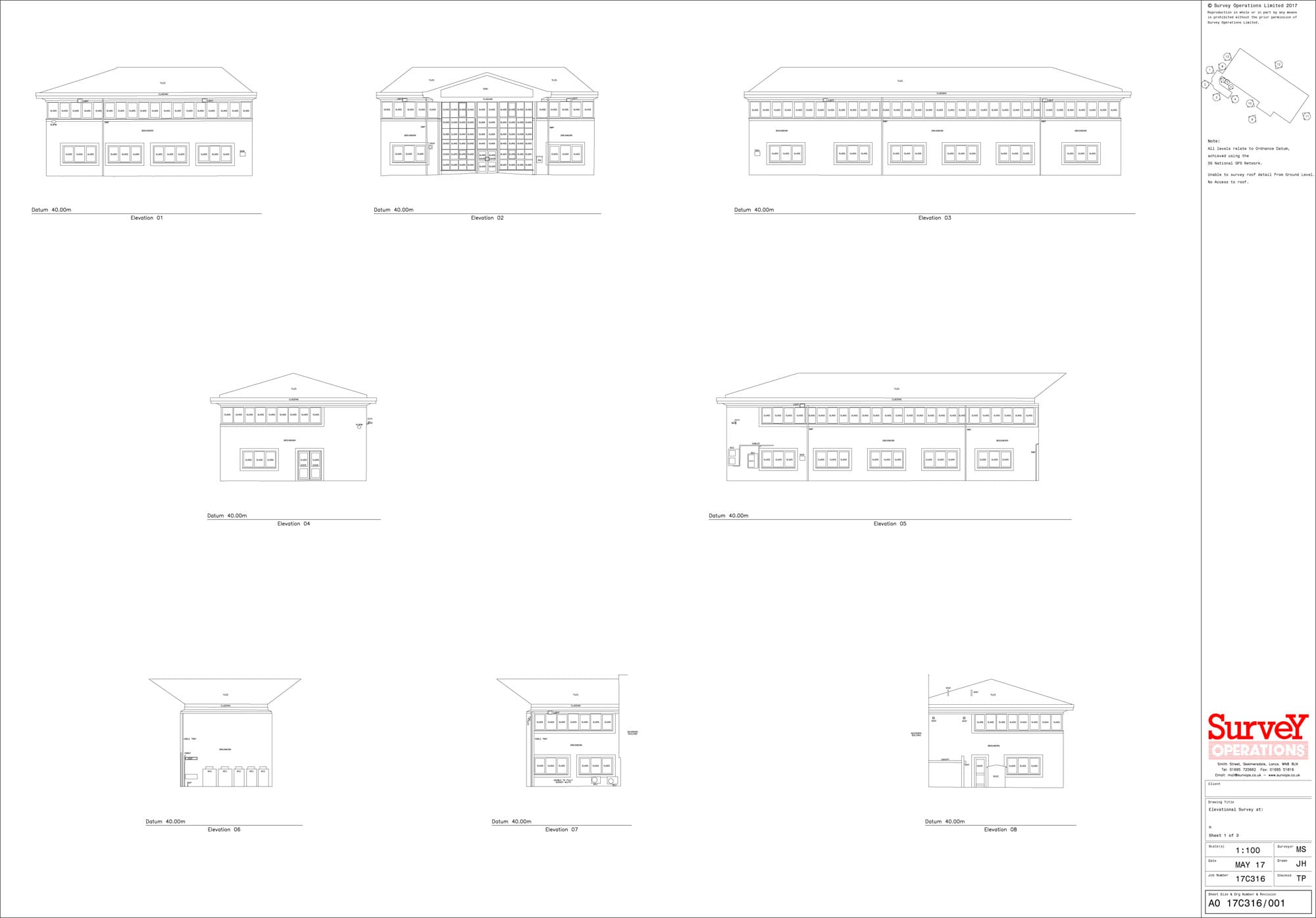
Using various techniques, buildings can be surveyed for basic floor and elevation layouts for planning, fit-out purposes and redevelopment through 3d fly-through computer models for visualisations of future design proposals.
Technology
Using laser scanning and mobile mapping technology, measured site data can be produced into a ‘point-cloud’ format; this provides millions of unique points of reference to allow designers to see building features in great detail. This is supplemented by 360-degree photogrammetry, providing more detailed building conditions.
Using UAV methods to access roof details provides full coverage of roof construction and high-level building conditions.
Contact Survey Operations today to enquire about Measured Buildings Surveys.




Measured Building Technology
Measured building surveys are comprehensive surveys that produce detailed plans and representations of buildings. They are crucial for architects, engineers, and property developers, providing a precise depiction of a building’s dimensions, layout, and structural elements. These surveys encompass detailed floor plans, elevations, sections, and ceiling plans, capturing every aspect of the building’s structure and architectural features.
Our technology in this field allows designers and architects to view and understand building features in extraordinary detail. The point-cloud data offers a three-dimensional representation of the building, facilitating more accurate and efficient design and planning processes. This approach ensures full coverage of the building, including hard-to-reach areas, and enhances the safety and efficiency of the survey process.
Our use of cutting-edge technology, combined with our expertise in this field, ensures that we deliver high-quality, detailed, and accurate surveys, essential for successful building management and redevelopment projects.
Measured Building Surveys FAQs
Supporting Services for Measured Building Survey Projects
Measured building surveys are often required for refurbishment, redevelopment, design, planning, conservation and asset management projects. Depending on the level of detail required, measured building survey data may be supported by additional services to provide more complete drawings, models and digital records of the existing structure.
For projects where complex buildings, heritage sites or detailed structural information needs to be captured accurately, our 3D laser scanning surveys can provide highly detailed spatial data. Where the captured data needs to be processed into accurate 2D or 3D outputs, our 3D CAD modelling service can support design, planning and technical documentation.
Measured building survey data can also be developed into digital models for projects that require more advanced design coordination or asset information. Our BIM surveys can support Building Information Modelling requirements, while our point cloud surveys can provide detailed scan data for accurate modelling, drawing production and long-term building records.
These supporting services can work alongside measured building surveys to help clients move from accurate site data to practical outputs for design, refurbishment, construction and building management.
Need accurate measured building survey data?
If your project requires floor plans, elevations, sections, 3D laser scanning, CAD modelling or BIM-ready outputs, our team can advise on the most suitable survey approach. Contact Survey Operations to discuss your requirements.