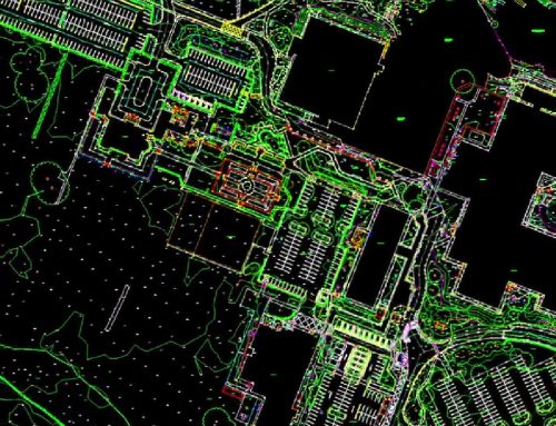
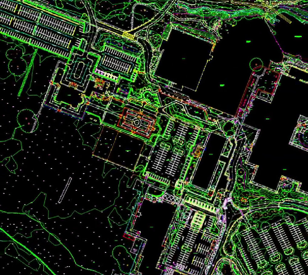
At Survey Operations, we are always looking for ways to deliver faster, safer and more accurate survey data for our clients. One of the most effective tools in our workflow is UAV LiDAR, and recently we deployed our WingtraOne GEN II drone to capture high-density survey data across a 36-hectare site, all from the air.
This type of project demonstrates exactly why UAV LiDAR is becoming an essential part of modern surveying and geomatics.
Surveying from the Air
Traditional ground surveys can be time-consuming, particularly across large or difficult terrain. UAV LiDAR allows us to rapidly capture millions of survey points across large areas in a fraction of the time, without compromising on accuracy.
Using the WingtraOne GEN II fixed-wing drone, we were able to fly the site efficiently and safely while capturing high-density LiDAR data and imagery simultaneously. The result is a highly detailed dataset that can be used for topographical surveys, terrain modelling, volume calculations, drainage analysis, planning and design.
For this particular site, covering 36 hectares, the aerial survey allowed us to complete data capture far quicker than traditional methods, while also reducing time spent working on uneven ground and around site hazards.
High Density Data, High Accuracy Results
LiDAR technology works by emitting laser pulses towards the ground and measuring the time it takes for them to return. This produces an extremely dense and accurate point cloud, capable of capturing ground levels even through vegetation and complex terrain.
From this data, we can produce:
- Topographical surveys
- Digital Terrain Models (DTM)
- Digital Surface Models (DSM)
- Contours
- Cross sections
- Volumetric calculations
- Feature mapping
- Site planning data
This level of detail gives clients the clarity they need to make informed decisions early in a project, reducing risk, delays and unexpected costs later on.

Efficiency for Large Sites
Large sites are where UAV LiDAR really shows its value. Whether it’s infrastructure projects, land development, quarries, landfills, utilities or environmental surveys, aerial LiDAR surveys allow us to cover significant areas quickly and efficiently.
The benefits include:
- Rapid data capture over large areas
- Reduced time on site
- Improved safety
- High accuracy survey data
- Ability to survey difficult or inaccessible terrain
- Detailed terrain and feature modelling
By combining UAV technology with our experienced survey team and processing workflows, we are able to deliver survey outputs that integrate seamlessly into design, engineering and planning workflows.
Elevating Surveying
UAV LiDAR is not replacing traditional surveying, it is enhancing it. By combining aerial data capture with ground survey control and verification, we can deliver comprehensive survey datasets tailored to each project.
The WingtraOne GEN II drone is a key part of this workflow, allowing us to capture high-quality LiDAR and photogrammetry data efficiently and reliably across a wide range of project types.
As projects continue to grow in size and complexity, aerial surveying will play an increasingly important role in providing fast, accurate and reliable spatial data.
Survey Operations continues to invest in technology and workflows that allow us to deliver better data, faster turnaround times and safer survey solutions for our clients.
Surveying, elevated, literally.
Talk to Us About Your Survey
If you’re planning a project and need accurate, reliable survey data, our team is here to help. Whether your site is large, complex or difficult to access, Survey Operations can deliver high-quality UAV LiDAR and topographical surveys tailored to your project requirements. Get in touch with our team to discuss your survey needs.


