One of the biggest risks facing designers, engineers, and contractors isn’t what’s on the surface, it’s what lies beneath it. Buried utilities such as gas mains, water pipes, power cables and telecoms can cause serious disruption if they’re not identified early.
At Survey Operations (SurvOps), we carry out utility surveys in accordance with PAS 128, helping project teams reduce risk, avoid costly delays, and plan with confidence.
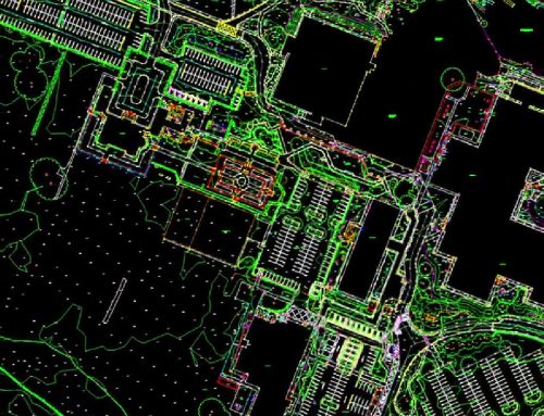
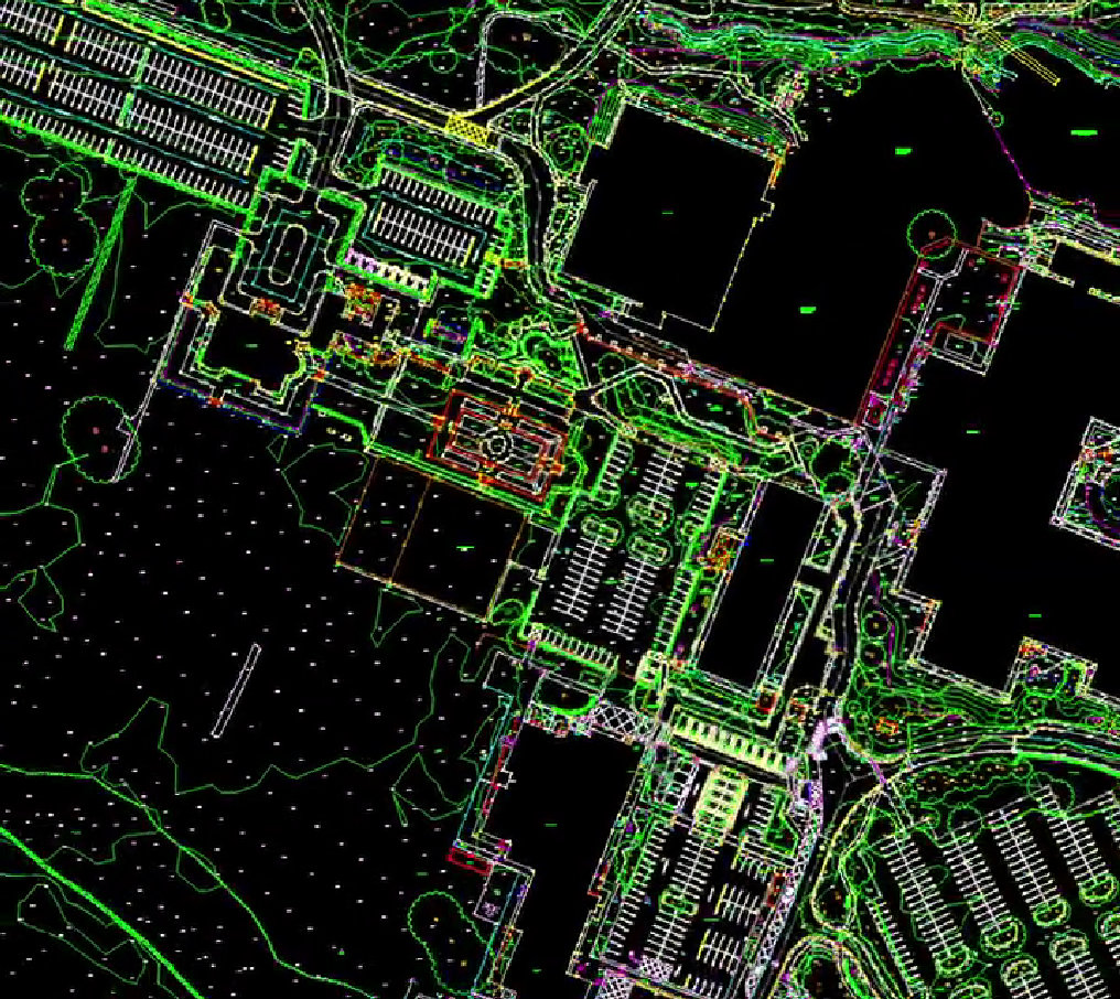
What You’re Seeing in the Video
The visual in this post is a short video that “scans” across a surveyed area. It represents the way our survey data is captured and interpreted to build a detailed picture of underground services, transforming complex detection outputs into clear, usable deliverables.
What Is a PAS 128 Utility Survey?
PAS 128 is the UK’s recognised specification for underground utility detection, verification and location. It sets a consistent framework for how surveys should be carried out and helps establish confidence in the quality and traceability of results.
If you’re new to the standard, this guide explains why it matters: Why PAS 128 Utility Surveys Are Essential for Safe Construction.
Why Utility Surveys Matter Before You Break Ground
Underground services can be congested, undocumented or misaligned with historical records. A high-quality utility survey helps you avoid the most common site risks by providing clarity early, before enabling works, excavation or piling begins.
- Reduced risk of strikes and delays by identifying buried services before intrusive work starts.
- Better design decisions using accurate data that supports planning and coordination.
- Fewer costly disruptions by minimising rework and unexpected interruptions.
- Improved safety for site teams and the public through clearer service awareness.
For a broader overview of survey types and when they’re required, see: Understanding Different Types of Surveys & When You Need Them.
How Survey Operations Captures and Maps Underground Utilities
We combine proven detection methods with experienced interpretation to deliver results that are accurate, traceable and practical for real project use. Depending on the site environment and project needs, this can include advanced techniques such as:
- Ground Penetrating Radar (GPR) for detecting non-metallic or non-conductive services.
- Electromagnetic Location (EML) for tracing conductive utilities.
- Additional supporting methods where appropriate (e.g., drainage and ductwork alignment).
Learn more about our GPR capability here: GPR Surveys (Ground Penetrating Radar).
For PAS 128-focused mapping outputs, visit: Utility Mapping to PAS128.
What You Receive
Survey results are typically supplied in recognised drawing and CAD formats, making them straightforward to use across design, planning and construction workflows.
If your project combines multiple survey disciplines, you may also want to explore our wider services: Utility Surveying, Construction Surveying, and Land Surveys.
When Should You Book a Utility Survey?
The best time is early during feasibility, design development or pre-construction when changes are easier and cheaper to implement. Having reliable underground data upfront helps you plan safer excavations, reduce programme risk, and avoid avoidable surprises.
Talk to Us About Your Utility Survey
If you have a plan or image showing the area to be surveyed, and any specific requirements, we can advise on the best approach for your site.
Contact Survey Operations to discuss a PAS 128 utility survey, or explore our Utility Surveys service page for more detail.
Interested in who we are and our background? Visit: About Survey Operations.

