Enhancing Surveying Capabilities with In-House Aerial Surveys
At Survey Operations, we deliver cutting-edge surveying solutions that combine speed, accuracy, and efficiency. One of the key ways we achieve this is through our advanced aerial survey services, utilising both photogrammetry and LiDAR technology.
Why Use Aerial Surveys?
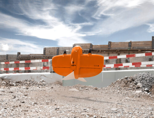
Aerial surveys provide a fast, efficient, and cost-effective way to gather detailed spatial data over large areas. Using UAV (unmanned aerial vehicle) technology, we can access hard-to-reach or hazardous environments safely—without compromising on data quality.
Photogrammetry and LiDAR: What’s the Difference?
We offer both photogrammetry and LiDAR depending on the project requirements:
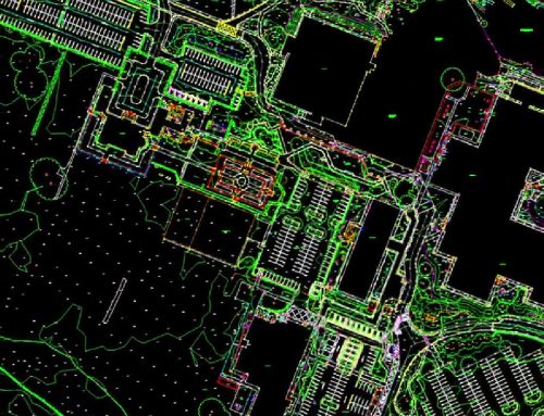
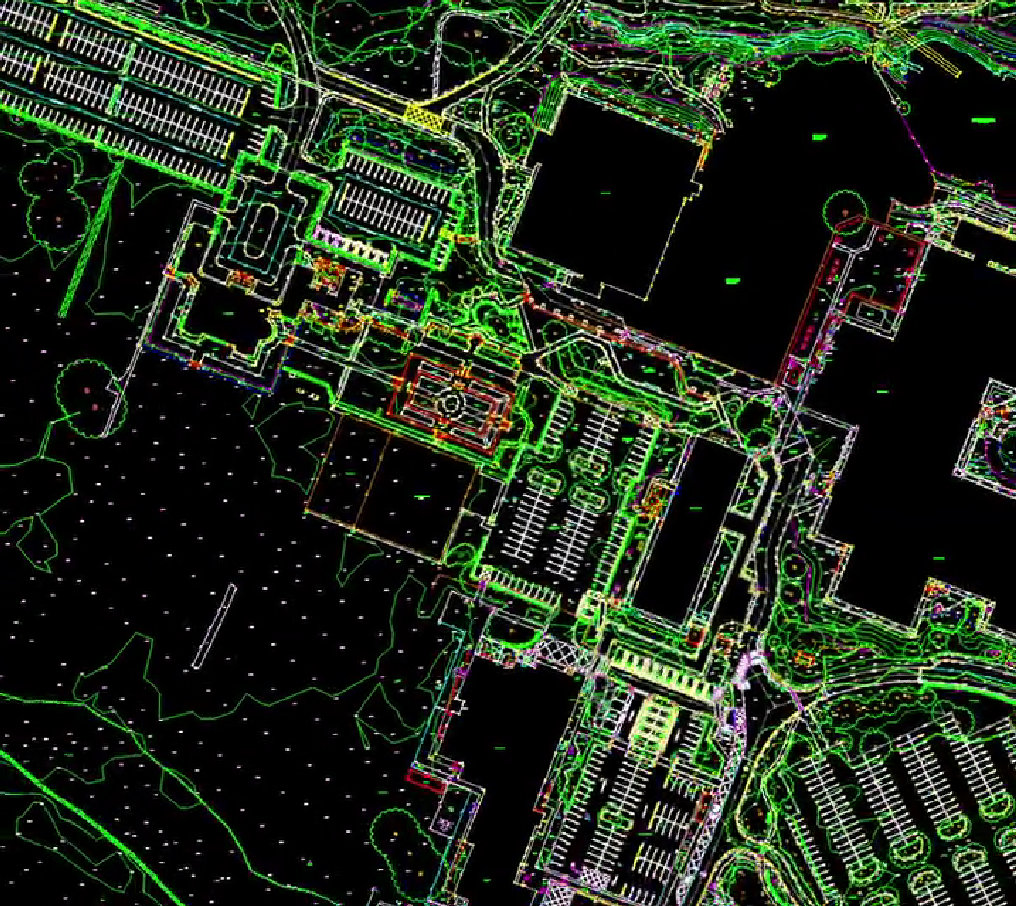
Photogrammetry involves capturing high-resolution imagery that can be processed into orthomosaics and 3D models.
LiDAR (Light Detection and Ranging) uses laser scanning to generate accurate point clouds, even in areas with dense vegetation or limited visibility.
By offering both technologies, we ensure the right tool is used for the job—delivering reliable data tailored to your needs.
Large-Scale Coverage, Rapid Results
Our drone surveys are capable of covering hundreds of hectares in a single day, allowing for rapid data collection on even the largest sites. This speed is especially valuable for time-sensitive projects or when regular site updates are needed.
Fully In-House Processing
All aerial data is flown and processed by our in-house team, giving us complete control over quality and turnaround times. This also enables us to offer bespoke deliverables such as:
- Digital terrain models (DTMs)
- Digital surface models (DSMs)
- Point clouds
- Orthomosaic maps
- Volumetric analysis
Applications Across Industries
Our UAV survey services are suitable for a wide range of sectors, including:
Why Choose Survey Operations?
With a dedicated team of experienced professionals and a strong commitment to quality, Survey Operations ensures every survey is completed to the highest standard. Our UAV surveys offer:
- High accuracy data outputs
- Efficient project turnaround
- Competitive pricing
- Complete service from flight to final deliverables
Get in Touch
If you’re looking for a reliable partner for your next aerial survey project, contact Survey Operations today. We’re here to help you collect the data you need—quickly, safely, and accurately.

