Lidar Scan Reveals Lost Mexcian City Deep in The Jungle
Archaeologists recently stumbled upon a lost Mayan city in Mexico’s Campeche jungle using Lidar technology, revealing a hidden metropolis featuring temples, amphitheatres, and causeways—all previously cloaked under dense vegetation. This remarkable discovery underscores how Lidar, a laser survey technology, transforms our understanding of hidden landscapes and buried histories.
The ancient city, dubbed “Valeriana,” was hidden within an area the size of Edinburgh. Researchers identified complex structures and intricate infrastructure that had once supported 30,000 to 50,000 people, evidence of the Maya civilisation’s advanced societal organisation and architectural sophistication. This new knowledge challenges past misconceptions, revealing the Tropics as a cradle for flourishing civilisations, rather than isolated settlements.
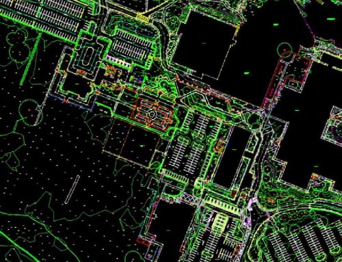
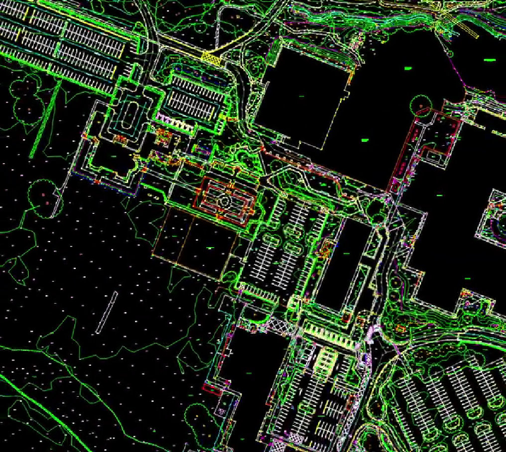
Lidar, a remote sensing technique, is revolutionising fields like archaeology, where it has been mapping areas once explored by foot. At Surv Ops, we leverage similar state-of-the-art Lidar technology to generate highly accurate, 3D landscape models across various industries, including environmental monitoring, construction, and heritage exploration. With our expertise, clients can map terrain in challenging conditions, enabling insights and discoveries that traditional methods may overlook.
Our Lidar surveys allow detailed visualisations of buried or hidden structures, identifying landscapes, roadways, or artefacts with a precision unmatched by other surveying tools. Whether your needs are archaeological, developmental, or environmental, Surv Ops brings advanced technology to the forefront, helping unlock the past and build the future.

