At Survey Operations, every survey begins with a simple objective: capture the land as it truly exists, with accuracy, clarity, and detail that professionals can rely on. Behind every project is a combination of advanced technology, experienced surveyors, and carefully processed data that transforms real-world environments into precise digital information.
The video featured in our recent post showcases the results of a detailed topographical survey, where millions of measured points are processed into a fully detailed mapping model. What you see in the video is not just a drawing or a plan, it is a highly accurate digital representation of the site, capturing everything from buildings and car parks to kerbs, road markings, landscaping, and level changes.
Turning Data Into Usable Information
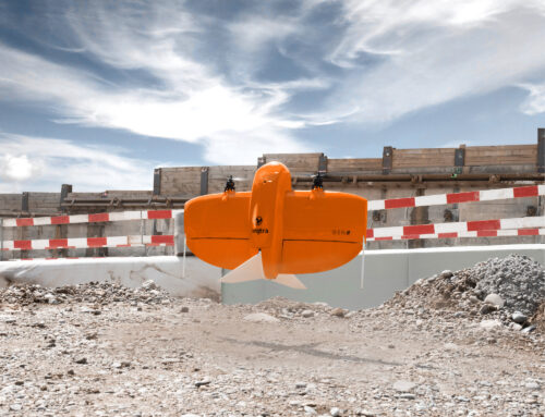
Modern topographical surveys go far beyond traditional measurement methods. Using advanced surveying equipment and aerial data capture where required, we collect dense and accurate datasets that are processed into clear, structured survey drawings. These drawings provide engineers, architects, and planners with the reliable base information they need to design, plan, and build with confidence.
Every line you see in the mapping output represents a measured feature on the ground. Roads, drainage features, building outlines, services, vegetation, and terrain levels are all captured and organised into layers, allowing design teams to quickly interpret and use the information.
This level of detail is essential for:
- Planning applications
- Engineering design
- Construction planning
- Drainage design
- Infrastructure projects
- Land development

Accuracy That Supports Better Decisions
Accurate surveys reduce risk. When designers and engineers are working with reliable site data, projects run more smoothly, unexpected issues are reduced, and costly redesigns can be avoided. A high-quality topographical survey forms the foundation of any successful development or infrastructure project.
Our team focuses not only on collecting accurate data, but also on delivering clear, well-structured survey drawings that integrate seamlessly into CAD and design workflows.
From Field to Final Drawing
A survey project typically follows several key stages:
- Site reconnaissance and control setup
- Data capture using survey equipment and/or aerial mapping
- Processing and cleaning of survey data
- Feature extraction and CAD drafting
- Quality checks and final delivery
The result is a detailed topographical survey drawing that provides a complete picture of the site and supports the entire project lifecycle from planning through to construction.
Supporting Projects From Start to Finish
Topographical surveys are often the first step in transforming land into infrastructure, buildings, or public spaces. By providing accurate and reliable mapping data, we help ensure projects start with the right information and move forward with confidence.
Mapping the land truly does help shape the future, and it all begins with accurate survey data.
Start Your Project With Accurate Survey Data
Every successful project starts with reliable information. Our team provides high-accuracy topographical surveys and detailed mapping to support planning, engineering, and construction projects. Contact Survey Operations today to discuss your site and how we can support your project.


