Modern infrastructure depends on reliable, accurate, and timely information. When a structure begins to show signs of distress, cracks, deformation, water ingress, or material deterioration, engineers must act quickly. But understanding exactly what is happening beneath the surface requires more than traditional measurements.
This is where terrestrial laser scanning (TLS) and advanced photogrammetry come into their own. These technologies are not simply tools; they are integral to how we deliver clarity, confidence, and efficiency across the UK’s most challenging inspection environments.
Digitally Unrolling the Bridge Intrados
The process of capturing and analysing the underside of an arch or bridge has historically been limited by access constraints, safety considerations, and the inherent complexity of curved structures.
Using high-resolution laser scanners, our surveyors collect millions of measurement points within minutes, generating a precise 3D point cloud of the intrados. Combined with photogrammetric imagery, this dataset allows us to digitally unroll the structure for in-depth analysis, revealing hidden stress points and geometries.
The result is a flattened, highly detailed representation of the entire underside of the bridge, exposing:
- Variations in geometry
- Deformation or sagging
- Cracking patterns
- Stress concentrations
- Material defects
What once required extensive manual inspection can now be visualised and interrogated from any angle, all without prolonged closures.
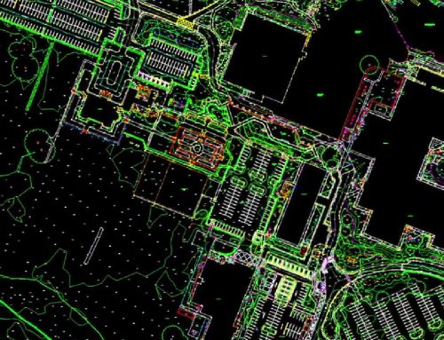
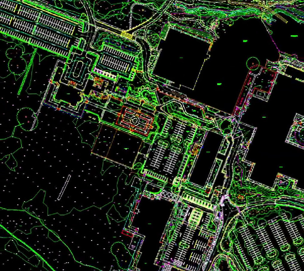
From Point Clouds to Actionable Insights
A point cloud is more than a collection of coordinates; it is the foundation of informed engineering decisions.
Our team processes the scan data to produce:
- Condition assessments
- Volume and displacement calculations
- Heritage-sensitive records for conservation and repair planning
- BIM-ready models for integration into wider project workflows
Every deliverable is created with accuracy, repeatability, and long-term usability in mind, ensuring engineers, architects, and asset managers can rely on the dataset for years to come.
A Safer, Faster, and More Detailed Approach to Infrastructure Care
Compared with traditional inspection methods, terrestrial laser scanning offers clear advantages:
- Non-intrusive surveying reduces downtime and operational disruption.
- Millimetre-level precision reveals issues invisible to the naked eye.
- High-density datasets allow for retrospective analysis as structures change over time.
- Enhanced safety: keeps teams away from hazardous zones.
- Integrated modelling supports repair planning and future-proofing.

For ageing bridges or those subjected to heavy traffic loads, environmental pressures, or structural uncertainty, terrestrial laser scanning delivers the certainty required to plan repairs, monitor change, and maintain public safety.
Supporting the Future of UK Infrastructure
Since 1986, Survey Operations has been at the forefront of surveying innovation. Today, our combination of terrestrial laser scanning, photogrammetry, UAV imagery, mobile mapping, and engineering expertise enables us to support the UK’s infrastructure with precision.
Whether for heritage archways, modern composite bridges, or complex transport structures, our specialists provide the data needed to bridge the gap between damage and durability.
If you’re planning an inspection, structural assessment, or long-term monitoring programme, our team is ready to assist with a tailored solution built on accuracy, innovation, and decades of experience. Contact us for more information.

