Every successful development begins with a clear understanding of the land. Whether you’re planning a residential build, commercial development, infrastructure upgrade, or environmental project, having precise, reliable data about your site is critical. That’s where topographical surveys come in.
At Survey Operations, we deliver comprehensive topographical surveys that map the terrain and surface features of a site in meticulous detail. Our expert team combines deep industry knowledge with cutting-edge technology to support clients in making confident, informed decisions from day one.


What is a Topographical Survey?
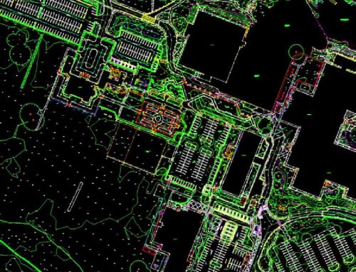
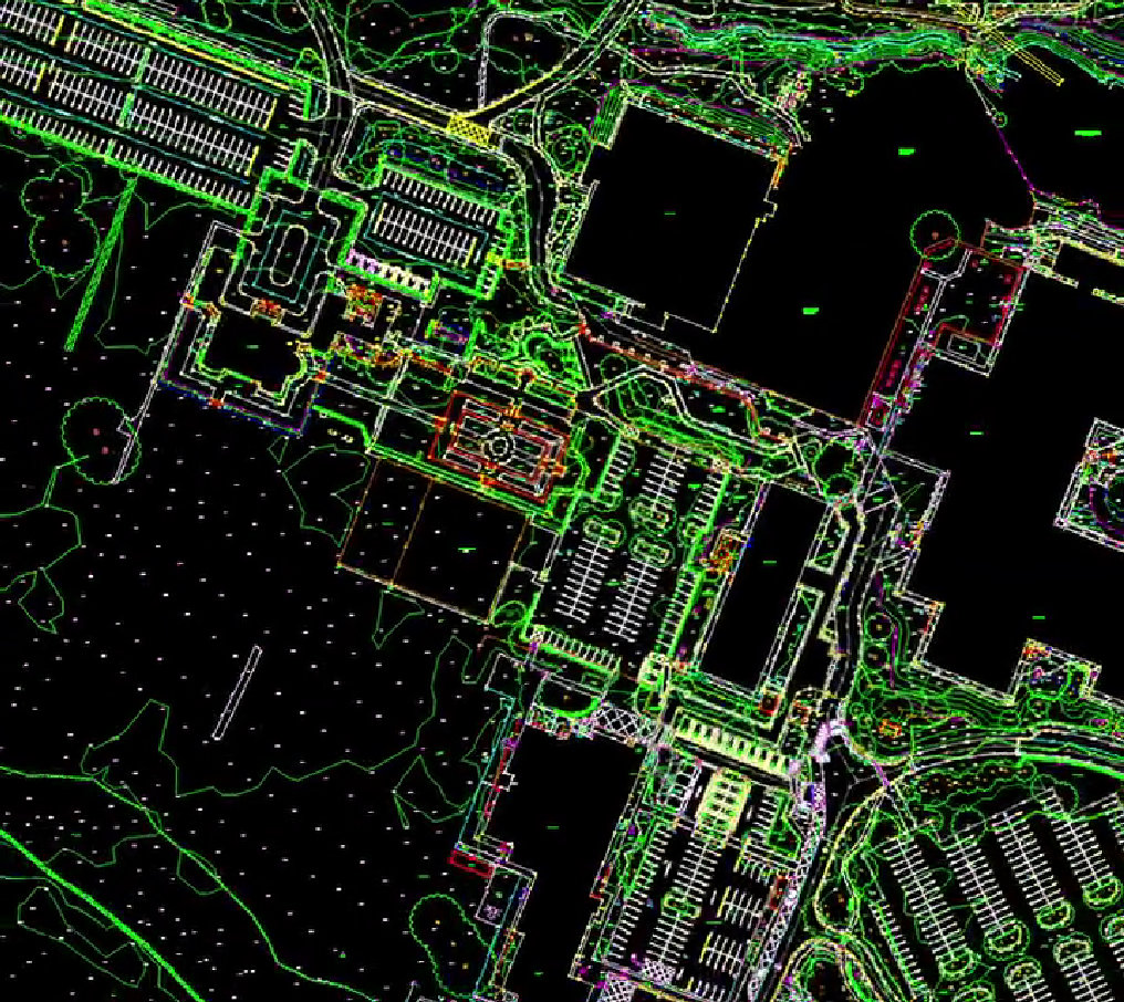
A topographical survey (also known as a land or topo survey) is a detailed, scaled mapping of the features of a site. It includes both natural elements—such as trees, watercourses, and ground elevations—and man-made structures like buildings, roads, fences, drainage systems, and utilities.
These surveys are crucial at the outset of any project, offering a visual and data-rich representation of the land that serves as the blueprint for further design, planning, and analysis. With topographical data in hand, stakeholders can minimise risk, avoid costly surprises, and streamline project timelines.
Where Are Topographical Surveys Used?
Topographical surveys are indispensable across multiple industries and project types, including:
Construction & Engineering
Architects, civil engineers, and developers rely on accurate survey data to design buildings and infrastructure that suit the landscape. Understanding elevation, gradients, and existing features ensures design feasibility and structural integrity.
Urban & Rural Planning
For planners, a detailed map of current land use and terrain helps in zoning, site selection, road planning, and ensuring compliance with planning regulations.
Environmental Management
Topographical data is used to assess natural habitats, flood plains, and drainage patterns. It supports environmental impact assessments (EIAs), helping teams reduce ecological disruption and plan for sustainability.
Utilities & Infrastructure
Infrastructure providers use topo surveys to map out pipelines, cable routes, transport links, and service access. This helps avoid interference with existing assets and ensures safe, efficient installations.
Flood Risk Assessment & Water Management
Understanding site elevations and water flow is critical in assessing flood risk.
Topographical data supports the design of effective drainage systems and informs flood mitigation strategies.
Our Technology: Precision Through Innovation
At Survey Operations, we don’t just rely on traditional methods. We invest in the latest survey technologies to deliver faster, more accurate results, even in challenging environments.
GNSS (Global Navigation Satellite System)
Using high-precision GPS systems, we determine exact geographical locations and elevation points with minimal margin for error.
LiDAR (Light Detection and Ranging)
LiDAR scans the terrain using laser pulses to generate dense, three-dimensional models of the land. It’s ideal for capturing fine detail over large areas or where vegetation obscures the ground.
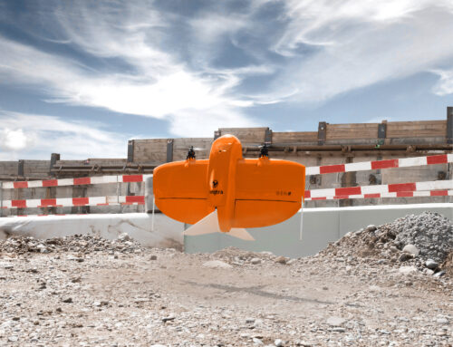
UAVs (Drones)
Drone surveys allow us to access difficult or expansive sites quickly and safely, capturing aerial imagery and data that can be processed into orthophotos and 3D terrain models.
Mobile Mapping Systems
Mounted on vehicles, these systems are perfect for roadside and urban surveys, rapidly collecting data without interrupting traffic or footfall.
The result? High-quality CAD drawings, 3D models, digital terrain models (DTMs), and point cloud data delivered in your preferred formats.
Why Choose Survey Operations?
With a dedicated team of experienced professionals and a strong commitment to quality, Survey Operations ensures every survey is completed to the highest standard. Our UAV surveys offer:
- High accuracy data outputs
- Efficient project turnaround
- Competitive pricing
- Complete service from flight to final deliverables
Get in Touch
If you’re looking for a reliable partner for your next aerial survey project, contact Survey Operations today. We’re here to help you collect the data you need—quickly, safely, and accurately.

