Reservoir spillways are one of the most important assets in the UK’s water infrastructure. They ensure the safe release of water, protect surrounding communities, and help secure long-term resource management.
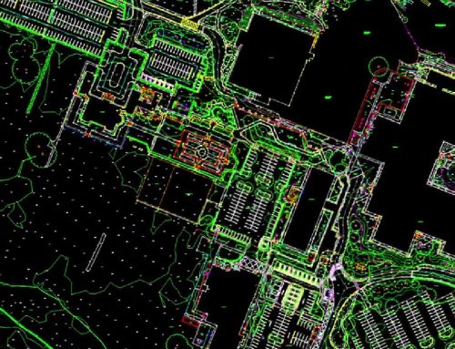
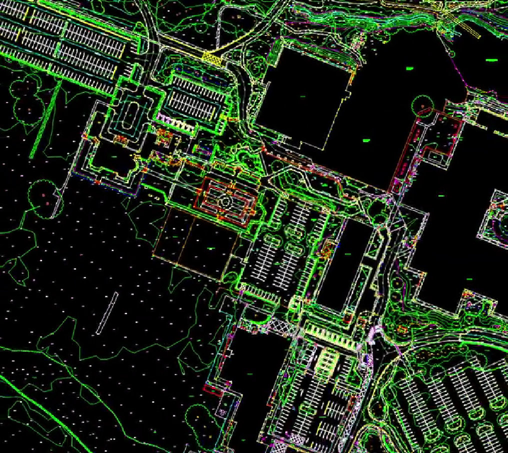
We recently carried out a detailed laser scanning survey of a major reservoir spillway. Using advanced 3D laser scanning technology, we captured the full structure with millimetre precision, providing engineers with the data they need for safe and effective asset management.

High-Accuracy Data Capture
Traditional survey methods often struggle to deliver the density of information needed for large, complex structures. By contrast, laser scanning produces a rich 3D dataset, recording every joint, contour and surface detail in exceptional accuracy.
For reservoir engineers and asset managers, this creates a true-to-life digital record of the spillway as it exists today. This can be used for structural assessment, monitoring over time, or as the basis for design and upgrade works.
Why Laser Scanning Matters for Spillways
Reservoirs are exposed to continuous pressures, water flow, environmental conditions, and natural wear, all have an impact. Small defects can escalate quickly if they are not identified early. High-resolution survey data allows for:
- Structural integrity checks: repeat scans highlight subtle changes or areas of concern.
- Topographical accuracy: detailed mapping of spillway and surrounding ground conditions.
- Digital twin modelling: 3D outputs support predictive maintenance and planning.
- Future works support: accurate as-built records inform refurbishment and design projects.
Supporting Smarter Water Management
With over three decades of experience in the UK surveying industry, we bring together the latest technology and highly skilled surveyors to deliver practical solutions for clients in the water sector.
From reservoir surveys and hydrographic surveys through to engineering control, UAV mapping, and 3D modelling, our integrated approach ensures clients receive reliable, actionable data for decision-making.
Laser scanning is now an established tool in water infrastructure management, enabling engineers to maintain safety standards, extend asset life, and plan with confidence.
Find out more about our Reservoir Survey Services or contact us today to discuss how high-resolution laser scanning can support your next project.

